Maritime Inventions: Innovations In Maritime Navigation
Maritime has been an important route used by human beings for exploration and trade throughout history. In this blog post, we have compiled for you, Maritime Goods blog followers, information about the inventions made in nautical navigation, the inventions such as the compass, nautical charts, and GPS technology, how the sailors used the developments in navigation, and the technological advances in maritime history.
Sailors have used navigational instruments to safely steer their ships for centuries. However, with the development of technology, great innovations and inventions have also emerged in sea navigation. In this blog post, we will focus on the innovations and inventions that have emerged in marine navigation in recent years.
- GPS (Global Positioning System): GPS is one of the most important inventions that revolutionized marine navigation. GPS is used to determine the precise location of any point on Earth using signals from space. With the help of GPS, sailors can more precisely pinpoint their ship's position and targets. This increases navigational safety and allows one to follow the route more accurately.
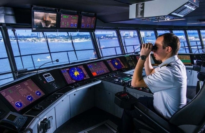
- Electronic Charts: While traditional nautical charts are an important tool for navigation, electronic charts have been a major milestone in navigation. It can be integrated with electronic maps, GPS, and other navigation systems and shows the ship's position in real-time. Also, electronic maps are easier to update and may contain more information. With electronic maps, sailors can more easily view underwater ground structures, depths, ship traffic, and other important details.
- AIS (Automatic Identification System): AIS, the Automatic Identification System, is a system that shares the location of ships and other important information. AIS allows ships to automatically communicate with each other and is of great importance in tracking ship traffic and reducing the risk of collision. AIS helps seafarers navigate safely by showing the location, speed, course, and identification information of other vessels.
- Submarine Robots: Submarine robots have become an extremely important tool for navigation and exploration at sea. These robots are used in underwater exploration, submarine exploration, and mapping of the submarine floor. Submarine robots support sailors' safe navigation with their ability to explore underwater, collect data and monitor environmental factors.
- Holographic Imaging: In traditional navigation systems, sailors have to follow information from various screens. However, holographic imaging technology allows seafarers to view information more quickly and interactively. Holographic imaging projects information onto the ship's windshield, helping sailors keep their eyes on the sea and not distract them.
While innovations and inventions in maritime increase the navigational safety of seafarers, they enable navigation to be done more accurately, quickly, and effectively. Technological advances such as GPS, electronic maps, AIS, submarine robots, and holographic imaging enable seafarers to have a better experience at sea. With future innovations, it will go further in the maritime industry and offer a safer sea voyage experience.